Tamworth Castle Community Archaeological Research
Providing skills development opportunities and enabling communities to explore their local heritage.
Ongoing projects funded by the Museum Development Art fund and UK Shared Prosperity Fund.
Project Summary
This long-term research project has been developed in collaboration with Tamworth Castle (Tamworth Borough Council) to identify and assess the surviving archaeological remains buried in and around the immediate landscape. Additionally, the project uses participatory archaeological research to positively engage local communities, schools, volunteers and under-served groups with their local heritage through hands-on activities and authentic archaeological investigations.
Since 2022, the team have used traditional and innovative archaeological techniques to investigate Tamworth Castle and its immediate landscape, successfully locating and investigating the former Castle Mill and various auxiliary buildings buried beneath the Castle Pleasure Gardens. Additionally, visualisations of existing castle structures have been produced.
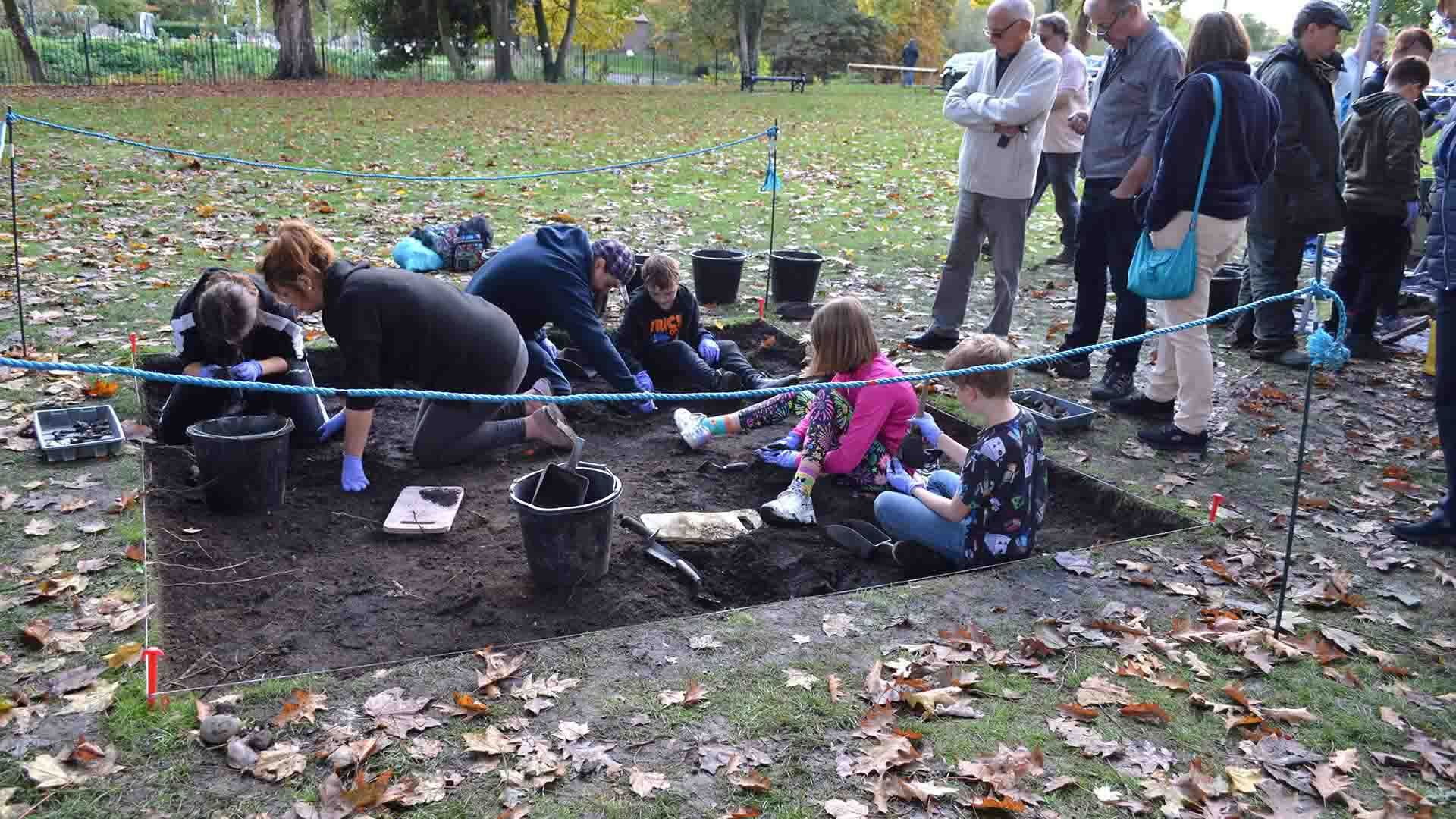
Community excavations of Tamworth Castle Mill have successfully identified and assessed the surviving remains of Tamworth Castle Mill. The 18th/19th-century mill, which was demolished in 1920 survives as buried foundations in the grounds of the castle.
Archival evidence confirmed that the mill went through a series of iterations beginning in the 12th century. It was initially a water-powered corn mill, powered by the flow of the River Tame and was later converted to a multi-storey water-powered cotton spinning mill (constructed in the Arkwright design) in the 18th century. A well-preserved substantial wall, which was identified in the excavations, supported the water wheel mechanism which drove the internal machinery.
The excavation provided the opportunity for structured volunteer and community engagement. It attracted hundreds of visitors and over 480 people (aged between 2 and 70) and local school classes, assisted in the investigations over the course of the project.
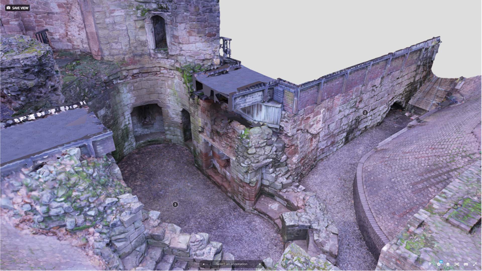
A conservation workshop was undertaken within Tamworth Castle’s 13th century gatehouse. Community volunteers assisted with the removal of rubbish and vegetation for the purpose of developing community capacity around Tamworth’s threatened resource and raising awareness of the continued conservation efforts. The gatehouse was then digitally mapped through a combination of photogrammetry, laser scanning and drone survey. The resulting 3D model being represents a means of allowing universal access to a usually inaccessible heritage space.
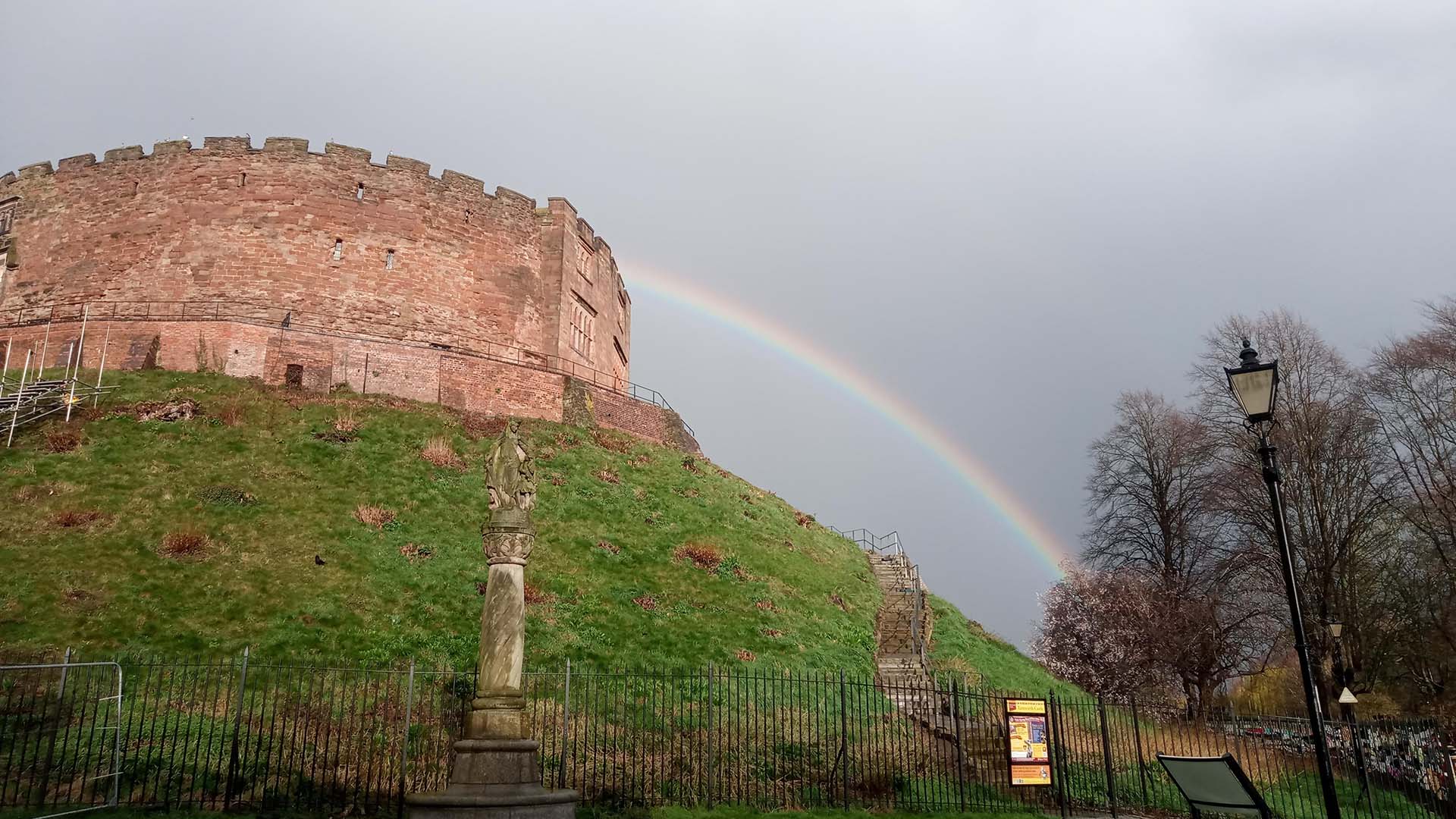
The late 11th-century Tamworth Castle survives as an earthen mound (motte) upon which is constructed a stone keep (the inner bailey). The motte stands in the north-west corner of the former outer (lower) bailey. The area of the lower bailey was largely stripped of its buildings when a pleasure garden was laid out in the late 18th century, although a number of buildings survived on the former bailey until the early 20th century.
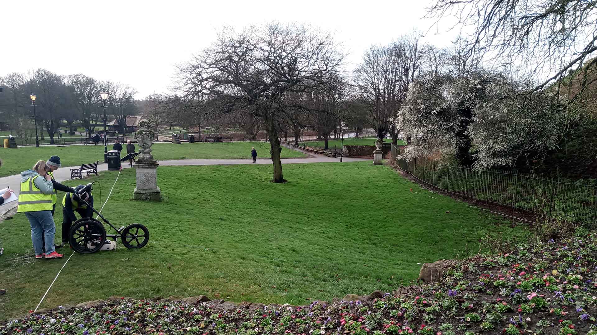
Members of the community supported a series of geophysical investigations which were undertaken across Tamworth Castle outer bailey, the purpose of which was to supplement the current historical and archaeological knowledge of the site. A ground Penetrating Radar (GPR) was used to map the below-ground evidence. Interpretation of the data has confirmed the likelihood that buried remains exist in the location of buildings known to have previously been present on the site. There is a high probability that remains relating to the early phases of the castle’s construction remain buried, preserved beneath the topsoil, despite numerous later landscaping episodes.
Future invasive investigations may be able to determine a more detailed phasing of the buried features and build upon the successful community response.
For further information and media content, please visit the following links:
- (23) Tamworth Castle - A 3D model collection by Centre-of-Archaeology - Sketchfab
- https://www.tamworthcastle.co.uk/archaeology